Argentine Pass
 |
| Maps: |


 |
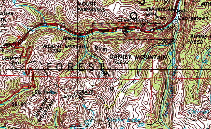
| USGS 7.5' Map: |
Grays Peak, Montezuma |
| Statistics: |
| Difficulty: |
Number: |
Miles: |
Altitude: |
Obstacles: |
Time: |
| Moderate 5 |
FR724 |
2.13 |
11,600 to 13,207 ft. |
Ledge Road - 1 |
1-2 hours |
|
| County: |
Clear Creek |
| Adopted by: |
Rising
Sun 4WD Club |
P.O. Box 260175
Lakewood, CO 80226-0175 |
|
| Managed by: |
Arapaho/Roosevelt National Forest,
Clear Creek Ranger District |
101 Chicago Creek
Idaho Springs, CO 80452 |
303-567-3000 |
| Summary: |
Argentine Pass is an old wagon road
that went from Waldorf over the Continental Divide to Horseshoe Basin
and then on to Keystone. Only the eastern side is drivable. |
| Attractions: |
Ghost Town,
Mining History, Scenic |
Seasonal
Closure: |
Natural - Closed by heavy snows |
| Best Time: |
June
- Early season. Could still have snow blocking the road
July - Best time
August - Best time
September - Best time
October - Snow may block the upper part of the
road
|
Trailheads
Accessed: |
Argentine Pass Trail (west side) |
| Camping: |
Dispersed
camping is available before the ghost town of Waldorf. The road up to
Argentine Pass does not offer any sites. |
| Base Camp: |
Base camping east of the ghost town
of Waldorf would give you a good location to explore the other 4WD
roads in the Leavenworth Creek drainage. |
| Fall Colors: |
Average - Most
of the fall color viewed from the Argentine Pass road would be of the
surrounding mountain valleys. |
| Navigation: |
To reach the Argentine Pass 4WD road
you will need to drive the Waldorf 4WD road that starts off of the
Guanella Pass road. From I-70 take exit 228 for Georgetown. Take 15th
Street to Argentine Street, turn right (west) on Argentine Street.
Follow Argentine Street for 0.3 miles to 11th Street. Turn left and
follow 11th Street to Rose Street. Turn right on Rose Street and go 0.5
miles to 2nd Street. Turn left on 2nd Street and climb the switchbacks
following County Road 381, the Guanella Pass Road. Go 2.5 miles and
take the right turn onto County Road 352, the Leavenworth Creek Road.
It will be at a turn on another set of switchbacks. There is a large
pull off there. Follow the Leavenworth Creek road to the ghost town of
Waldorf. Continue on through Waldorf to the west to start the Argentine
Pass 4WD road. |
| History: |
The need for a pass over the towering continental divide west of Georgetown was the rich gold and silver deposits in the Peru Creek and Snake River basins. In 1862 the Territorial Assembly chartered the Empire City, New Pass, Breckenridge and Montezuma City Road Company to contruct a road over "New Pass". The road never got started. Later this "New Pass" or Sanderson Pass, named after a family that ran a stagecoach over the pass, was constructed. On September 14, 1864, James Huff discovered silver
near Argentine Pass. This began the rush to Georgetown and the creation of the
Argentine Mining District.
In 1867 "Commodore" Stephen Decatur and the Georgetown and Snake River Wagon Road Company started upgrading the route to be a toll road. In 1869
when the road opened freight wagons for the local mines and passenger
stages used the road. Later, in the 1870s, the pass was named Snake River
Pass for the river to the west of the pass.
Once the Argentine Mining District became
known for its production of Gold and Silver the pass was renamed Argentine Pass. The Latin name for Silver is 'Argent'. Because of the narrowness and steepness of the road wagon accidents caused a few deaths. Wind, snow, and rock slides frequently closed the pass. Both sides of the pass were sites of heavy mining
activity, the Waldorf area on the east side and the Decatur and Chihuahua area on the west side.
|
| Description: |
Argentine Pass 4WD road starts just past the mine tailings west of the main part of Waldorf.
 |
Argentine Pass road heading west from Waldorf.
08/1998 |
It is numbered FR724.1. This is a combined road with FR248.1.
 |
Tailings at Waldorf from Argentine Pass road.
09/08/2003 |
|
Just past the mine tailings FR724.1 will head left to another mine. Continue on the 4WD road straight ahead signed FR248.1.
Argentine Pass reaches 13,207 feet. To the south is Argentine Peak at
13,738 feet.
 |
Argentine Pass.
09/08/2003 |
There is plenty of parking at the top of the pass, though early fall snow storms can eliminate the view.
Over the pass to the west is the faint trail of the western half of Argentine Pass. This was once a stage road. Over time the rocks have filled the cut back in
leaving only a faint outline of the stage road. Below is Peru Creek and the
mines of Horseshoe Basin.
 |
Argentine Pass, view of Peru Creek.
08/1998 |
From the top of the pass it is rumored that you can see 1/6th of the state
of Colorado.
 |
Argentine Pass, view to the west.
08/1998 |
|
|
Data updated: January 27, 2013
4WD Road driven: September 8, 2003
Copyright 4X4Explore.com - 2000-2013 |