Cumberland Gulch  |
| Maps: |


|
| USGS 7.5' Map: |
Empire, Central City |
| Statistics: |
| Difficulty: |
Number: |
Miles: |
Altitude: |
Obstacles: |
Time: |
| Easy 4 |
FR271 |
2.84 |
9,808 to 10,800 ft. |
NA |
1-2 hours |
|
| County: |
Clear Creek |
| Adopted by: |
|
|
|
| Managed by: |
Arapaho and Roosevelt National Forest,
Clear Creek Ranger District |
101 Chicago Creek Road
P.O. Box 3307
Idaho Springs, CO 80452 |
303-567-3000 |
| Summary: |
Cumberland Gulch road connect the Fall River road with Yankee Hill. |
| Attractions: |
Mine |
Seasonal
Closure: |
Natural - Closed by heavy snows |
| Best Time: |
June - May still be snowed in
July - Best
August - Best
September - Best
October - Possible early snows |
Trail Heads
Accessed: |
Cumberland Lookout - Hiking |
| Camping: |
There are a few camping spots at the top of Cumberland Gulch along FR271.1G. |
| Base Camp: |
This would be a good area to base camp and explore the 4WD roads around Alice and Central City. |
| Fall Colors: |
Average - The lower section of the Cumberland Gulch road goes through aspen groves. |
| Navigation: |
From Idaho Springs, I-70 exit 240, head west on I-70 and go 1.8 miles. Take exit 238 toward Fall River Road and go 0.3 miles. Turn right onto Fall River Road and go 7.1 miles. Turn right onto Cumberland Gulch Road. |
| History: |
|
| Description: |
From the hairpin turn on the Fall River Road just below the town of Alice you will turn off onto a dirt road that goes between the hill side and a rock outcrop. Just past this large rock outcrop is a private drive to two homes on the hill side below the road. Continuing on, the road will follow Cumberland Gulch as it heads through aspen groves. You will come to two quick switchbacks that continue your climb. The road will start to get closer to the gulch floor as you transition from aspen to pine forests.
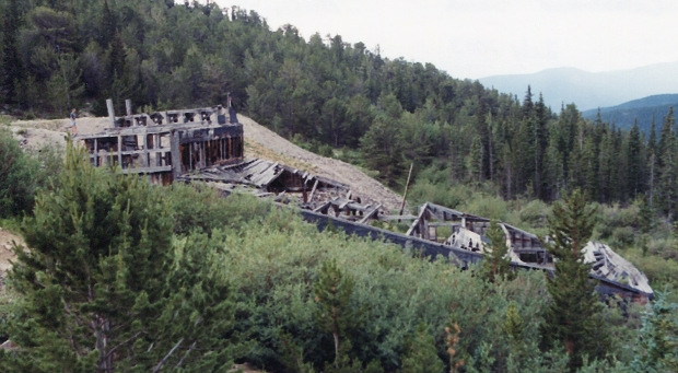
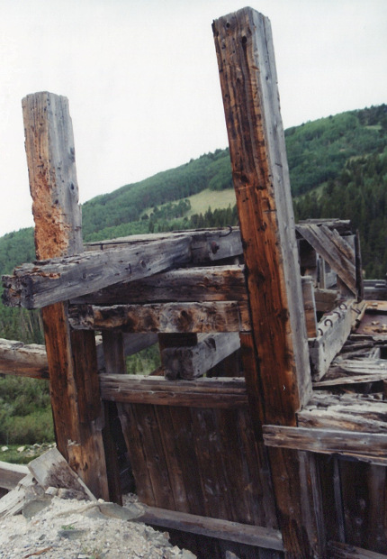
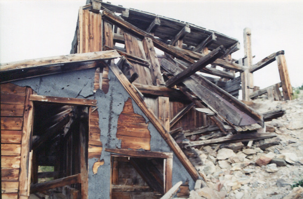
As the pine forest becomes thicker you will come to an intersection. The left road is Washoe Gulch, FR271.1D. Stay to the right to continue on the Cumberland Gulch road. You will now cross the gulch to the other side, and come to a small parking area. This is the trail head for the Cumberland Lookout hiking trail. The two track road will continue to climb up the gulch and shortly come to a small pond along the creek. The road gets a bit wider as it continues up the gulch. Next you will come to another larger pond with mine tailings on the right side of the road. Back in 2003 there were some mine building here.
|
Mine in 2003
photo by:
Adam M |
|
Mine in 2003
photo by:
Adam M |
|
Mine in 2003
photo by:
Adam M |
Continuing up the gulch you will come to an intersection. The road to the right is Sheridan Hill, FR271.1F. The left continues to climb to a braided area that is an intersection. The road the left is FR271.1G which heads west passing two spurs to campsites, then connecting with Washoe Gulch, FR271.1D and Yankee Hill, FR175. The right road, Cumberland Gulch, continues through the pine forest to also tie into the Yankee Hill road.
|
|
Data updated - May 16, 2019
4WD Road driven - June 12, 2010
Copyright 4X4Explore.com - 2000-2019 |

