

| Difficulty: | Number: | Miles: | Altitude: | Obstacles: | Time: |
|---|---|---|---|---|---|
| Easy 2 | FR684 | 5.28 | 9,840 to 10,750 ft. | NA | 1-2 hours |
Saguache Ranger District
Saguache, CO 81149
Closure:
July - Best
August - Best
September - Best
October - Early snows may close the higher section
Accessed:
From Del Norte, CO, to start on the west end of Deer Creek, head north on CO-112 E/Oak Street toward 5th Street. Continue to follow CO-112 E and go 3.2 miles. Turn left onto Grand Ave and go 2.7 miles. Continue onto County Road 38A and go 7.6 miles. Sharp left onto County Road 41G and go 10.1 miles. Turn left onto County Road M33 and go 8.9 miles. Turn right to start the Deer Creek road.
From Saguache, CO, to start on the east end of Deer Creek, head west on Gunnison Ave toward 9th Street for 0.1 miles. Turn left onto 10th Street and go 423 feet. Turn right at the 1st cross street onto County Road Z/Denver Ave and continue to follow County Road Z for 5.0 miles. Turn left onto County Road Cc36 and go 3.8 miles. Continue onto County Road CC36 and go 0.3 miles. Turn left onto County Road Z35 and go 2.5 miles. Turn left to stay on County Road Z35 and go 1.4 miles. Continue onto FR 706 and go 1.1 miles. Turn left at Forest Service FR 710.1A and go 2.6 miles. Continue onto FR 706 and go 266 feet. Turn left onto County Road 41G and go 6.5 miles. Turn right on the road coming down hill. This is the Deer Creek road.
From Saguache, CO, to start on the west end of Deer Creek, head south on 8th Street toward US Hwy 285 N and go 0.4 miles. Continue onto Gunbarrel Rd/US Hwy 285 S and go 17.1 miles. Turn right onto County Road G and go 5.0 miles. Turn right onto County Road 42/County Road G and continue to follow County Road G for 1.2 miles. Slight right onto County Road 41G and go 10.1 miles. Turn left onto County Road M33 and go 8.9 miles. Turn right to start the Deer Creek road.
 |
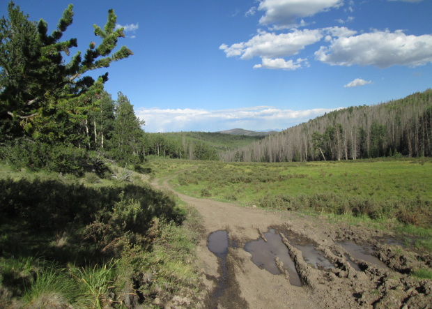
Meadow at the head of Deer Creek photo by: Adam M |
|---|
The road will be a two track that runs along the meadow with aspen trees intermixed with pine. As the meadow narrows the road will enter the pine forest and head up to a saddle and out of the Deer Creek drainage. The Deer Creek road is part of the Laughlin Stock Driveway. Along this climb in the forest you will pass through a fenceline.
 |
Just below the saddle photo by: Adam M |
|---|
The road will head down into the Lost Cabin Creek drainage and cross a long open meadow.
 |
Lost Cabin Creek photo by: Adam M |
|---|
At the far end of the meadow you will enter into the forest again. It will be a mix of pine and aspen. You will cross another low saddle in the forest and then come down to another open meadow, this time you will be on the southeast side. The road will cross over this short drainage to the northwest side and head north through aspens before coming out into an open area. Here there will be a short spur road on the left that goes to a campsite. The road will head downhill to connect with the Carnero Creek, FR41G, road.