Government Creek
 |
| Maps: |


|
| USGS 7.5' Map: |
Kings Canyon |
| Statistics: |
| Difficulty: |
Number: |
Miles: |
Altitude: |
Obstacles: |
Time: |
| Easy 3 |
FR 881 |
6.00 |
9,400 to 10,120 ft. |
NA |
1-2 hours |
|
| County: |
Jackson |
| Adopted by: |
|
|
|
| Managed by: |
Routt National Forest,
Parks Ranger District |
100 N. Main (P.O. Box 158)
Walden, Colorado 80480 |
(970)723-2700 |
| Summary: |
Government Creek 4WD road that climbs up to the power line towers above the North Sand Hills.
|
| Attractions: |
NA |
Seasonal
Closure: |
Natural - Closed by heavy snows
|
| Best Time: |
June - Possible snow drifts
July - Best
August - Best
September - Best
October - Early snows possible |
Trail Heads
Accessed: |
|
| Camping: |
There are a few dispersed sites along the road, past the power line towers. |
| Base Camp: |
This would be a good are to base camp and explore the roads north of the Walden North San Hills.
|
| Fall Colors: |
Poor - Mostly pine forest
|
| Navigation: |
From Walden, CO. head north on CO-125 N/Main Street for 13.2 miles. Continue straight onto CO-127 N for 3.6 miles. Turn right onto County Rd 6E for 276 feet. Continue straight onto County Rd 46 for 3.2 miles.
Turn right onto Co Rd 46A and go 0.4 miles. Turn hard right back and uphill to get onto Government Creek, FR881.
|
| History: |
|
| Description: |
Government Creek 4WD road leaves FR204, Pinkham Creek, and heads south to connect with FR882, which comes up from the North Sand Hills. The road has been maintained in the past along this section. Past the intersection you will climb up to one of the power line towers above the North Sand Hills. The road will head into the trees to the southwest then turn southeast. This is where the road gets narrower and a bit rougher. You will be running along a ridge in a dense forest.
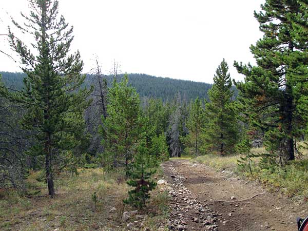 |
Heading down from the Power Line
photo by:
Adam M |
You will pass through the edge of a few short meadows before entering the trees again. The road remains the same difficulty as it heads to the east.
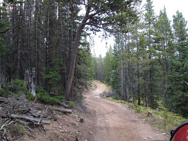 |
Middle section
photo by:
Adam M |
At a forested section of the road you will come to a sign indicating the boundary between the Forest Service Lands and the State Forest Lands. This is where Government Creek changes over to the Mendenhall Road.
|
|
Data updated - December 26, 2016
4WD Road driven - September 5, 2016
Copyright 4X4Explore.com - 2000-2016 |

