| Difficulty: | Number: | Miles: | Altitude: | Obstacles: | Time: |
|---|---|---|---|---|---|
| Easy 3 | Cnty 4, Cnty 104, FR105 | 22.50 | 8,400 to 11,925 ft. | NA | 3-4 hours |
Lake County
Pike/San Isabel National Forest, Leadville District
White River National Forest, Sopris District
505 Harrison Ave., Leadville, CO 80461
810 Front Street, Leadville, CO 80461
620 Main Street, Carbondale, CO 81623
(none)
(719)486-0749
(970)963-2266
Closure:
July - Late in the month
August - Best
September - Best
October - Watch for early snowstorms
Accessed:
Hagerman Tunnel Trail, FT1491 - Hiking
Lyle Creek Trail, FT1919 - Hiking
From Basalt, CO. head northeast on Midland Ave toward Basalt Center Circle. Go 0.2 miles and continue onto the Fryingpan Rd. Go 19.5 miles and continue onto County Road 4. Go 4.7 miles and continue onto County Rd 4/Frying Pan Rd. Go 3.8 miles passing the Chapman Campground entrance and continue on the Frying Pan Rd, which is the Hagerman Pass road.
In 1885 the Hagerman Tunnel was constructed as part of the Colorado Midland Railroad line (1887 to 1922) to connect Leadville with Aspen and Glenwood Springs. This 2,061 foot long tunnel sits at 11,528 feet altitude just south of Hagerman Pass.
 |
|---|
| Hagerman Tunnel, circa 1880s photo by: W.H. Jackson (the dark areas are snowsheds over the railroad line) |
As part of the switchbacks to reach this altitude the Hagerman Trestle, the most elaborate and spectacular in Colorado, was constructed on the hairpin turn above Busk. The Hagerman Trestle was 1,084 feet long, 84 feet high, and 200 degrees in curvature.
 |
|---|
| Hagerman Trestle |
 |
|---|
| Hagerman Trestle |
 |
|---|
| Hagerman Trestle |
The Busk-Ivanhoe Tunnel was started in 1890 and opened in 1893. It was used by the railroad until 1897. In 1899 the snowfall was so heavy that the Hagerman Tunnel was shut down. In October of 1899 the Busk-Ivanhoe Tunnel was purchased by the railroad, which is 575 feet lower (10,953 feet) than the Hagerman Tunnel. The Busk-Ivanhoe Tunnel is almost two miles long, but it eliminated 13 snowsheds and, 12 bridges and trestles required to gain the 575 feet of altitude. After 1921 the Busk-Ivanhoe Tunnel was called the Carlton Tunnel and shortly thereafter abandonded as a train route to become an automobile route. Due to its one lane an alternating east to west then west to east use had to be used. In 1943 there was a cave in on the west end and the Colorado Highway Department closed the tunnel.
 |
|---|
| Map of Hagerman and Ivanhoe-Busk Tunnels adapted from Haley, 1963 |
 |
|---|
| Hell Gate on the west side of Hagerman Pass photo by: H.H. Buckwalter, circa 1900 |
The railroad station of Sellar had a post office and Inn for railroad employees and travelers. The station was in Sellar Park, a flat open meadow along the main line. The facilies here included a water tank, sand house, coal bin, and a wye for turning the locomotives. The large rotary snow plows were also stored here. At the end of the wye were brick charcoal ovens used to convert wood to charcoal for use in the Leadville smelters. At the west end of the park is where the wye leaves the main line. Today the area around Sellar Park is part of the Coke Oven State Wildlife Area.
Scott, Glenn R. Historic Trail Map of Leadville : USGS, 2004. Online.
Helmuth, Ed and Gloria. The Passes of Colorado Boulder, Colorado: Pruett, 1994. Print.
Jessen, Kenneth Ghost Towns Colorado Style, Volumn 2, 1st ed. Loveland, Colorado: J.V. Publications, 1999. Print.
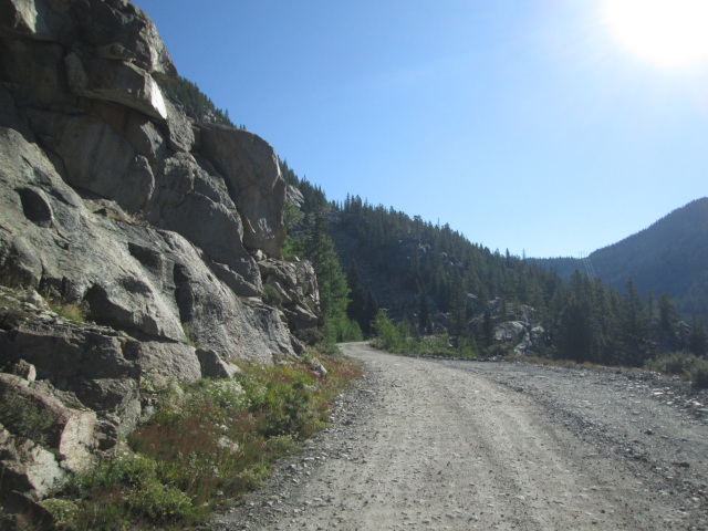
Continue on FR105 as you follow the old railroad grade. After about one mile you will come to another parking lot. This is the trail head for the trails that follow the old railroad grade to the footings for the Hagermand Trestle, to the old Hagerman Tunnel's east portal, and to Hagerman Lake. From here the road leaves the old railroad grade and becomes rougher and narrower.
 |
Looking back down toward Busk Creek photo by: Adam M |
|---|
 |
Another view toward Busk Creek photo by: Adam M |
|---|
You will climb through three switchbacks to get to the top of a ridge between Busk Creek and Glacier Creek. You will pass one of the ski huts used for cross country skiing in the winter.
 |
Looking back, heading for treeline photo by: Adam M |
|---|
 |
Smoother section of the road photo by: Adam M |
|---|
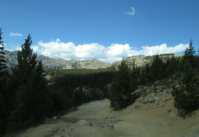
After gaining timberline you will come to a saddle with a sheer drop off that gives you views toward Busk Creek and Hagerman Lake below. Beyond the lake are two sections of the old railroad grade that worked its way up to the higher Hagerman Tunnel.
 |
Hagerman Lake and old railroad grades beyond photo by: Adam M |
|---|
 |
Climb to pass from Hagerman Lake overlook photo by: Adam M |
|---|
 |
Looking back toward Hagerman Lake overlook photo by: Adam M |
|---|
Just beyond this great view the road climbs a hill and rounds a rocky area to crest out at Hagerman Pass. There is a sign below the power lines that cross the divide here.
 |
Hagerman Pass photo by: Adam M |
|---|
 |
Hagerman Pass sign photo by: Adam M |
|---|
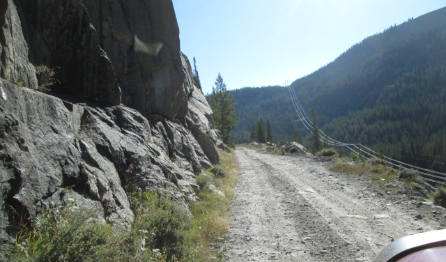
Forest Service road FR105 continues from here but you are now on the Sopris Ranger District of the White River National Forest instead of the Leadville Ranger District of the San Isabel National Forest. The road will follow the overhead power lines down to County Rd 104 near Ivanhoe Creek. Before this junction you will have to do two switchbacks and cross an irrigation ditch. Once on County Rd 104 you are back on the old railroad grade.
 |
Looking up toward Hagerman Pass from the west side photo by: Adam M |
|---|
 |
Hagermand Pass road under power lines photo by: Adam M |
|---|
 |
Ivanhoe Lake and old railroad grade photo by: Adam M |
|---|
Head west on County Rd 104 following the railroad grade. After about 1-3/4 miles the valley will drop away and the road will be cut into a ledge rising above the creek below. This is the famed "Hell Gate" section of the line.
 |
Hell Gate ledge section photo by: Adam M |
|---|
 |
Looking east toward Hell Gate photo by: Adam M |
|---|
The road will continue along the ledge face on the side of Sellar Peak for about a half mile before going back into the trees.
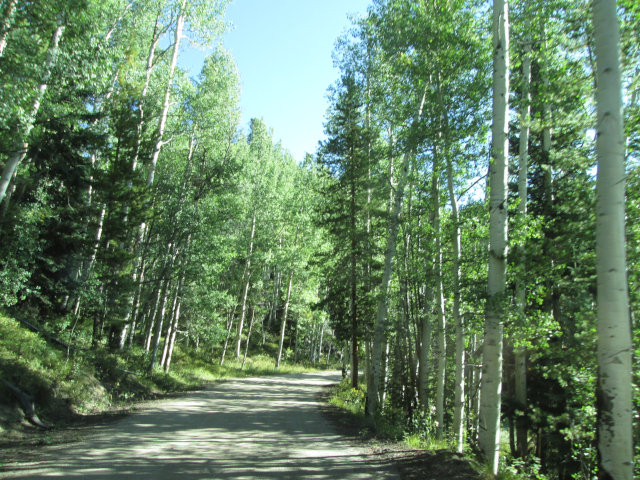 |
Aspens along the road photo by: Adam M |
|---|
The road will slowly descend through the trees passing a small park (open area) before looping around the north side of Sellar Park. At the west end of the park there is a right turn that takes you to Diemer Lake and Sellar Lake which is below Sellar Peak. Continuing on the railroad grade you will pass an old siding at the end of Sellar Park. The road will loop back to the east and descend toward Ivanhoe Creek, almost ending up below Hell Gate, before switching back and heading west again. The road will follow the Roaring Fork River and pass the Forest Service Chapman Campground, the town of Norrie, and loop around the north side of Ruedi Reservoir before reaching Basalt, CO.