| Difficulty: | Number: | Miles: | Altitude: | Obstacles: | Time: |
|---|---|---|---|---|---|
| Easy 2 | FR 107 | 4.30 | 10,630 ft. | NA | 1-2 hours |
Parks Ranger District
Walden, Colorado 80480
Closure:
July - Best
August - Best
September - Best
October - Early snows possible
Accessed:
From Granby, CO head west on US-40 W/E Agate Ave toward South 1st Street. Continue to follow US-40 West for 3.0 miles. Turn right onto CO-125 North and go 26.4 miles. Sharp left onto Forest Service Road 106 and go 10.0 miles. Sharp right onto FR730 and go 1.4 miles. Left turn on to FR107, Poison Ridge road.
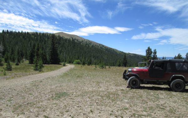 |
Poison Ridge with Sheep Mountain in the background photo by: Adam M |
|---|
At this ridge the Poison Ridge Hiking Trail crosses the road continuing to the northwest. There is a spur road to the southeast that stops at a parking spot and a hiking trail heads to the top of Sheep Mountain.
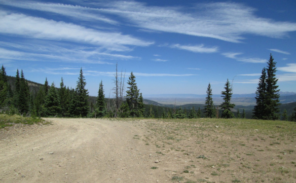 |
Looking north photo by: Adam M |
|---|
From the ridge the road heads down to Sheep Creek. This section I have not driven but I used Google Earth to describe the rest of the route.
The road will head through thick pine forest making three sharp switchbacks as it descends down to cross Sheep Creek. After crossing the creek the road heads down the valley following Sheep Creek, though the road is above the creek. The forest a bit thinner as the road heads down the valley. It will take a short detour up a side gulch and then return to continue down the valley. You will pass a spur road on the left that goes to a dispersed campsite or hunting camp. From here the road will only travel a short distance before ending above the intersection of Sheep Creek and Troublesome Creek.