| Difficulty: | Number: | Miles: | Altitude: | Obstacles: | Time: |
|---|---|---|---|---|---|
| Moderate 7 | FR 565 | 10,000 to 12,801 ft. | Rock - 3 Steep - 2 |
4-5 hours |
South Platte Ranger District
Morrison, CO 80465
Closure:
July - Late in the month if the snow has melted.
August - Best
September - Best
October - First snows will close the road.
Activities:
Hiking -
Equestrian -
Mountain Bike -
ATV -
Motorcycle -
Activities:
Snowshoeing -
Cross Country Skiing-
Snowmobile -
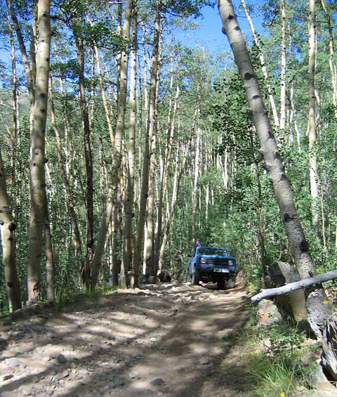 |
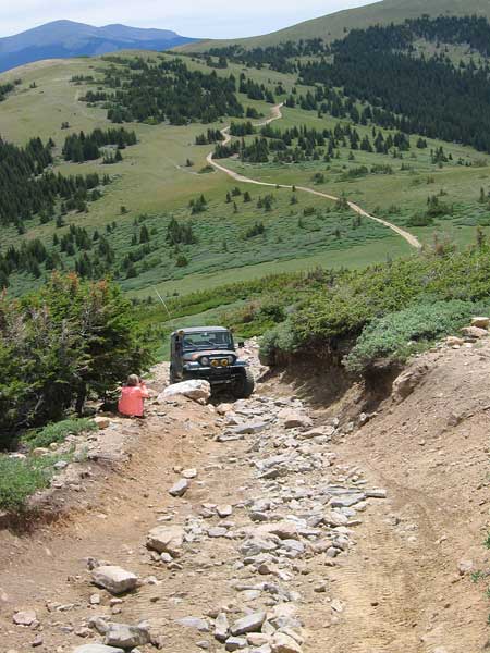
Climbing to Sawmill Gulch photo by: Adam M |
|---|
 |
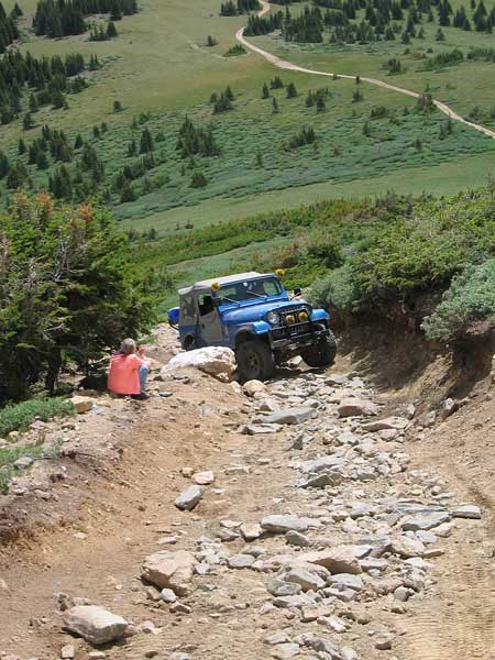
Sawmill Gulch photo by: Adam M |
|---|
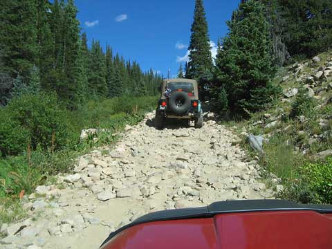
There will be larger openings in the forest with a few more rocky hills to climb before you enter a stand of large pine trees and navigate two switchbacks between the large trunks.
 |
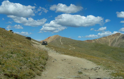
Large openings in the forest photo by: Adam M |
|---|
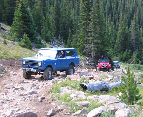
This section has some tight sponts. As you leave the stand of pine you will be above timberline as you head toward the southern ridge of Redcone.
 |
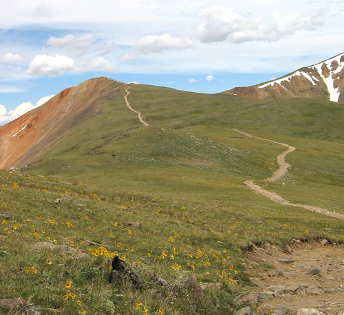
Southern ridge with obstacle part way up photo by: Adam M |
|---|
On the steep slope in front of you is a large clump of bushes that marks the two ways over the steep rocky obstacle on the way to the top of the ridge. At one time one side may have been easier than the other, but they both offer different challenges for different types of vehicles.
 |
Looking back down at the right side route in the previous picture photo by: Adam M |
|---|
 |
Closer shot of the obstacle photo by: Adam M |
|---|
 |
The approach to Red Cone photo by: Adam M |
|---|
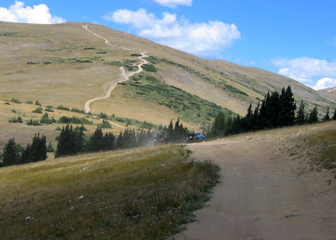
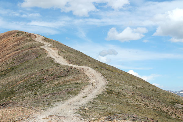
After making it through the obstacle you will follow the ridge giving you great views of the surrounding mountains.
 |
Closer shot of the approach to Red Cone photo by: Adam M |
|---|
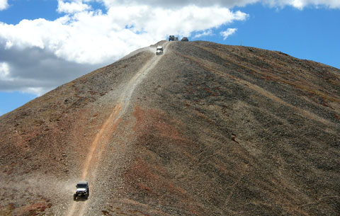
The last steep uphill section is the final ascent to the top of redcone. There is very little space for vehicles on top and you will be completely exposed to the elements, but the view are great from the high vantage point on top of Redcone.
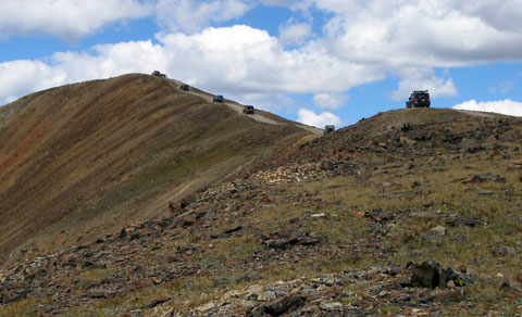 |
The ridge on the way to the top photo by: Adam M |
|---|
 |
Final climb to Red Cone photo by: Adam M |
|---|
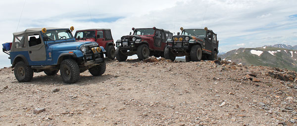 |
The top of Red Cone photo by: Adam M |
|---|
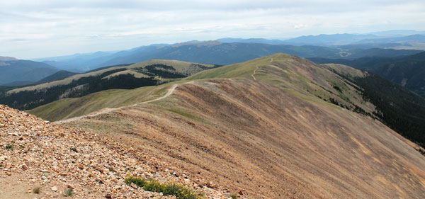 |
Looking south at the ridge from the top of Red Cone photo by: Adam M |
|---|
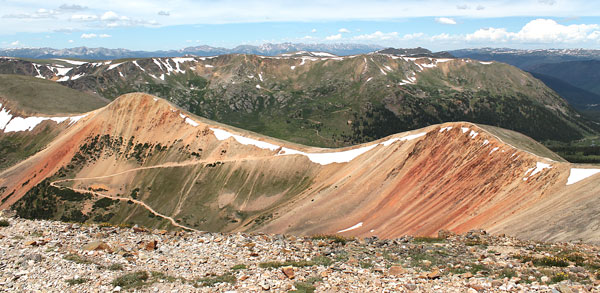 |
Webster Pass from Red Cone photo by: Adam M |
|---|
From the top you will immediatly start down the extemely steep descent of the north side of Redcone. This section of the 4WD road is loose and offers the risk of your vehicle back end coming around. Watch using the breaks if this happens as it may put you sideways on this extremely steep hill. Toward the middle of the decent is the steepest section that has a reddish color and is rough than the upper section.
 |
Coming down the north side of Redcone photo by: Adam M |
|---|
At the bottom the road levels out and you head northwest along another ridge of Redcone. There will be another steep descent that take to the end of the ridge above Webster Pass. From here there is one more descent, steep than the second one, before you come out onto Webster Pass.
 |
Final descent to Webster Pass photo by: Adam M |
|---|
From Webster Pass you can head north to Montezuma, CO or south back down Handcart Gulch to where you started.