| Difficulty: | Number: | Miles: | Altitude: | Obstacles: | Time: |
|---|---|---|---|---|---|
| Easy 2 | FR 715, 721 | 7.00 | 9,700 ft. | NA | 1-2 hours |
Parks Ranger District
Walden, Colorado 80480
Closure:
July - Best
August - Best
September - Possible snow
October - Snow likely
Accessed:
Snyder Creek Loop, FT1226 - Motorcycle, Mountain Bike, Horseback, Hike
Sidewinder, FT1226.1A - Motorcycle, Mountain Bike, Horseback, Hike
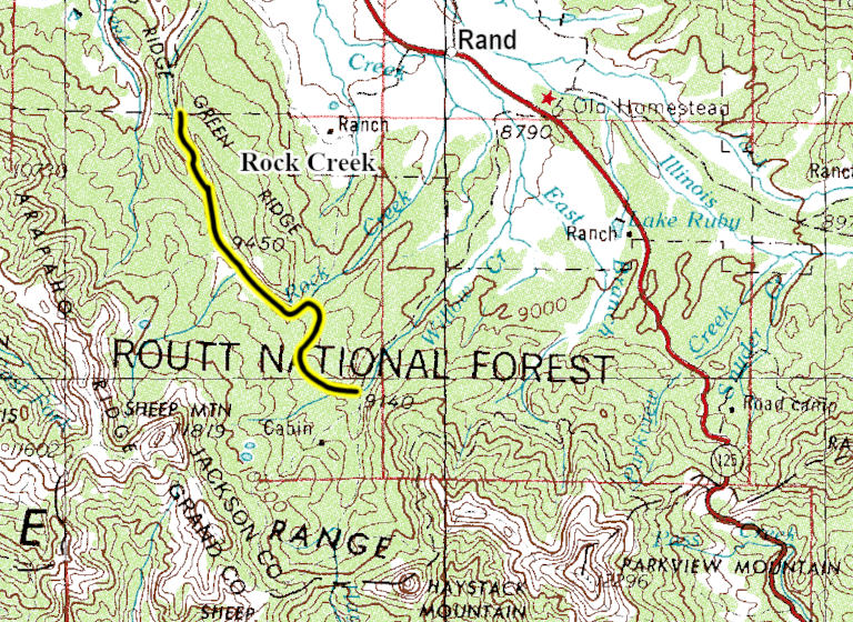
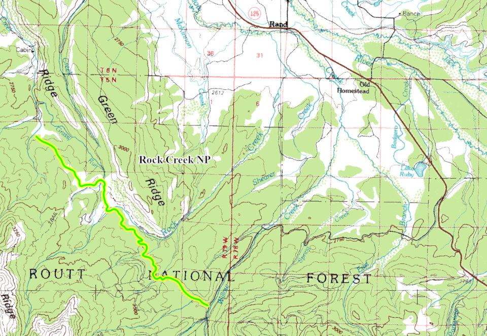
From Granby, CO head west on US-40 W/E Agate Ave toward South 1st Street. Continue to follow US-40 West for 3.0 miles. Turn right onto CO-125 North and go 26.4 miles. Sharp left onto Forest Service Road 106 and go 7.10 miles. Right tuen onto FR715, Rock Creek NP road.
I have not driven this road but I used Google Earth to describe the route.
The Rock Creek NP road is a wide two track that is somewhat maintained. It does not have any major obstacles. Starting from the Willow Creek Road it follows a small side valley up into the forest and then across rolling hills headed toward Green Ridge. Part way through the valley you will pass the connection with FT1226.1A on the right. Continuing up the valley you will pass FT1226 on the right as you crest a small ridge. From here the road drops down to work its way over rolling hills passing a few spur roads to dispersed campsites before crossing Rock Creek. After crossing Rock Creek you will head through a wide open valley below Green Ridge which is to your right. The road will head back into the forest and follow above Grassy Run creek. After passing a few more spur roads to dispersed campsites you will climb a low ridge and come to an intersection, the road to the left is FR721 which heads along the ridge to the south for about a mile to the Grassy Run trail head. Staying with the main road you will head over the ridge into a forested area passing two more dispersed campsites before coming to the roads end at a turn around.