Round Hill
 |
| Maps: |


|
| USGS 7.5' Map: |
Fairplay West |
| Statistics: |
| Difficulty: |
Number: |
Miles: |
Altitude: |
Obstacles: |
Time: |
| Easy 3 |
FR 426 |
3.20 |
10,780 to 11,200 ft. |
NA |
1-2 hours |
|
| County: |
Park |
| Adopted by: |
|
|
|
| Managed by: |
Pike Nat. Forest,
South Park Ranger District
|
320 Hwy 285, P.O. Box 219
Fairplay, CO 80440 |
(719)836-2031
|
| Summary: |
Round Hill is an alternate road to Breakneck Pass that runs along Sheep Ridge. |
| Attractions: |
Mine, Scenery |
Seasonal
Closure |
Agency - January 1 to June 15 |
| Best Time: |
June - Late, may still be snowed in
July - Best
August - Best
September - Best
October - Early snows may close road |
Trail Heads
Accessed: |
FT 739 (Motorcycle) |
| Camping: |
Their are a few dispersed camp sites at Breakneck Pass where FR426 and FR175 cross. |
| Base Camp: |
This would be a good area to base camp and explore Browns Pass, Breakneck Pass, and the other short spur roads out of Sheep Park. |
| Fall Colors: |
Very Good - There are aspen groves all along Sheep Ridge. |
| Navigation: |
From Fairplay, CO. head southeast on Main Street toward 5th Street for 0.5 miles. Turn right onto CO-9 S/US-285 S and go 4.7 miles. Turn right onto County Rd 5 and go 1.7 miles. Turn right onto Breakneck Pass Road and go 3.4 miles. At the top of Breakneck Pass the road that crosses to the south and north is Round Hill 4WD road.
|
| History: |
|
| Description: |
From Sheep Park off of Breakneck Pass road, FR175, the Round Hill road heads up Sheep Ridge. The climb will get steeper as you go further into the forest and it will start doing a few switchbacks. In about a half mile the road will turn right. To the left is the Sheep Ridge Mine.
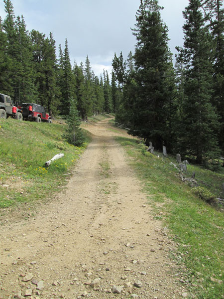 |
Road at Sheep Ridge Mine
photo by:
Adam M |
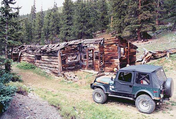 |
Sheep Ridge Mine in 2003
photo by:
Adam M |
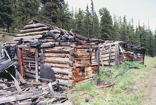 |
Sheep Ridge Mine in 2003
photo by:
Adam M |
From the mine the road heads south along Sheep Ridge through the aspen groves. It makes a bee line to Breakneck Pass where it crosses FR175 and continues south toward Round Hill.
 |
Heading to Breakneck Pass and Round Hill
photo by:
Adam M |
After crossing the pass the road goes another mile before it ends. Beyond the official road end the forest will open up to large meadows and private property with small ranches in a wide valley at the base of Weston Pass.
|
|
Data updated - November 15, 2020
4WD Road driven - August 30, 2014
Copyright 4X4Explore - 2000-2021 |

