

| Difficulty: | Number: | Miles: | Altitude: | Obstacles: | Time: |
|---|---|---|---|---|---|
| Moderate 6 | FR203 | 1.10 | 8,840 to 9,400 ft. | Rock - 3 | 1-3 hours |
Boulder Ranger District
Boulder, CO 80301
Closure:
July - Best
August - Best
September - Best
October - May get early snow.
Accessed:
From Lyons, CO. head west on CO-7 W/5th Ave for 14.2 miles. Turn left onto CO-72 E and go 4.1 miles. Turn right onto Middle Saint Vrain Road and go 0.4 miles passing through the Peaceful Valley Campground. Turn right onto Forest Road 105 and go 0.9 miles. Turn left onto Forest Road 202 and go 0.2 miles. Turn right onto the T-33 Crash Site 4WD road, Forest Road 203.
From Nederland, CO. head west on W 2nd Street and go 0.3 miles. Continue to follow CO-72 W for 17.3 miles. Turn left onto Middle Saint Vrain Road and go 0.4 miles passing through the Peaceful Valley Campground. Turn right onto Forest Road 105 and go 0.9 miles. Turn left onto Forest Road 202 and go 0.2 miles. Turn right onto the T-33 Crash Site 4WD road, Forest Road 203.
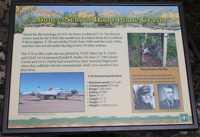 |
Sign photo by: Adam M |
|---|
 |
Start of T-33 road photo by: Adam M |
|---|
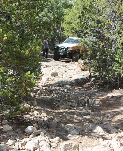
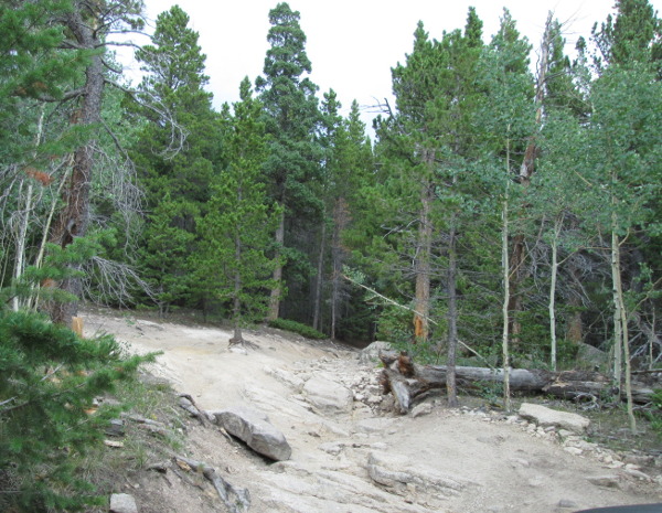
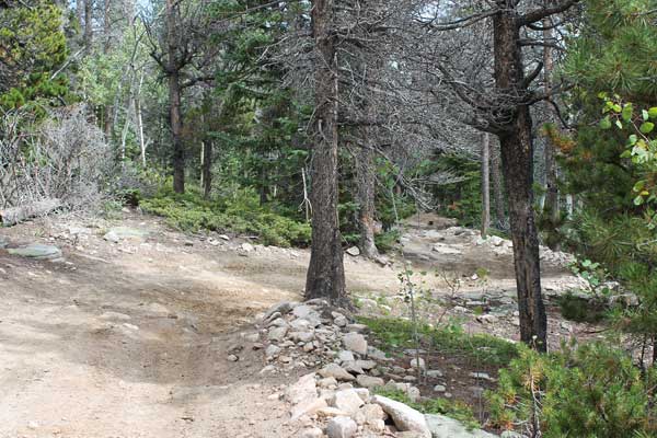
It isn't long before you come to an area with three routes through the trees. This is the first obstacle. Each of the routes has a different challenge level.
 |
Lower obstacle (2022) photo by: Adam M |
|---|
 |
Lower obstacle (2022) photo by: Adam M |
|---|
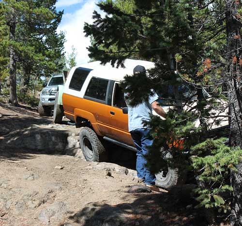
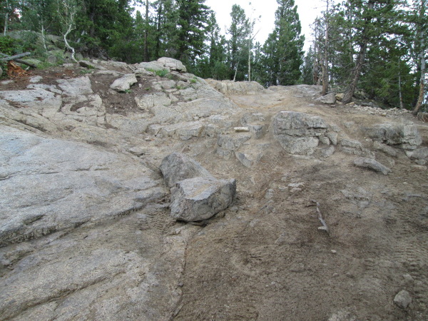
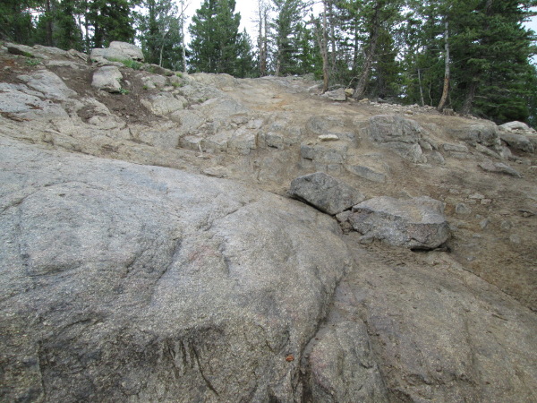
Beyond this spot the road becomes a bit narrower. Next you will come to a rock step and then a large rock outcropping with a 'V' notch to the left side. This is the main obstacle.
 |
Main obstacle, lower (2009) photo by: Adam M |
|---|
 |
Main obstacle, step (2009) photo by: Adam M |
|---|
 |
Main obstacle (2022) photo by: Adam M |
|---|
 |
Main obstacle (2022) photo by: Adam M |
|---|
 |
Main obstacle (2022) photo by: Adam M |
|---|
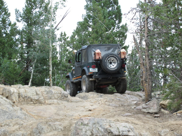 |
Brian M on main obstacle (2022) photo by: Adam M |
|---|
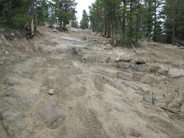
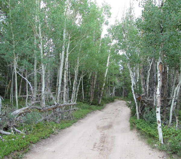
After climbing to the top of the obstacle the road heads back into the trees. The road stays a bit rough and will come to a long straight section with an upper and lower part.
 |
Road beyond main obstacle photo by: Adam M |
|---|
The top will narrow and you will have to navigate a rock to get to the lower section and continue. Just at this wide area you can turn and drop down to the lower section. Beware of the trees on the passenger side.
After this obstacle the road continues in the trees and comes to a right turn. The left dead ends. After turning right you will work through some narrow sections of trees and tree roots to another wide spot.
 |
Through the trees photo by: Adam M |
|---|
 |
Road beyond main obstacle photo by: Adam M |
|---|
Continue through this spot on the narrow and tree lined road a short distance to the parking area and turn around. There is an interpretive sign at this parking area.
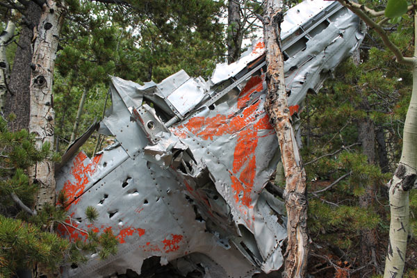 |
Crash debris photo by: Adam M |
|---|
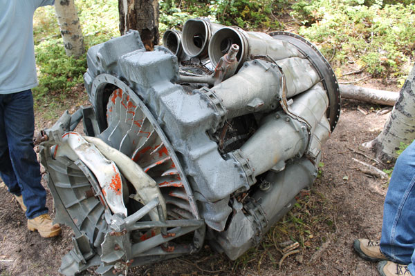 |
Crash debris photo by: Adam M |
|---|
 |
Crash debris photo by: Adam M |
|---|