| Difficulty: | Number: | Miles: | Altitude: | Obstacles: | Time: |
|---|---|---|---|---|---|
| Easy 2 | FR 752 | 6.68 | 9,413 to 10,070 ft. | NA | 1-2 hours |
Gunnison Ranger District
Gunnison, CO 81230
Closure:
July - Best
August - Best
September - Best
October - Good. May have early snows
Accessed:
Cameron Gulch, FT549 - Hike, Horseback, Mountain Bike, Motorcycle
Gold Creek, FT427 - Hike, Horseback, Mountain Bike, Motorcycle
From Buena Vista, CO. head west on W Main Street toward W Lake Street for 0.7 miles. Continue onto State Hwy 306 and go 18.5 miles. Continue onto County Road 209 and go 12.5 miles. Turn left onto County Road 742 and go 2.2 miles. Turn left onto County Road 55 and go 0.6 miles. Turn right onto FR 752.
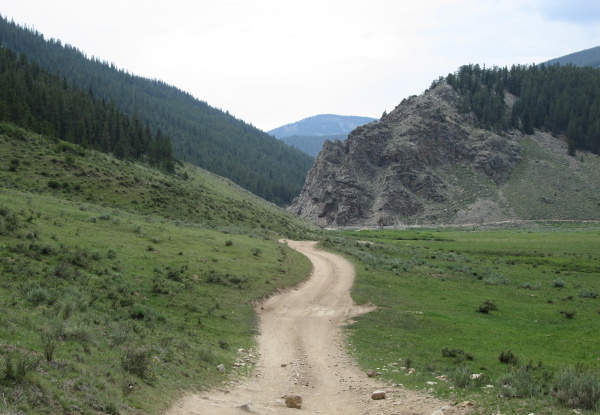 |
Start of road near Taylor Reservoir photo by: Adam M |
|---|
The road will follow this valley to its upper end and then head into the trees. At a curve you will pass an intersection where Lakeview Campground Trail, FT621, connects with the road, coming in on the right. Just past this intersection you will come to the top of a saddle with a road to your left, right, and straight ahead. There will also be a few campsites here. The road on the left is Kentucky Ridge, FR758.1, that will dead end. The road on the right is not on the Motor Vehicle map, and it will also dead end. Staying straight ahead you will head down into an open small valley. Toward the bottom you will pass a spur road on the right that goes to a campsite. The main road will climb up a short ridge and come to another intersection. The road to the left, FR752.1F, runs along the top of the ridge to a few dispersed campsites before connecting back to the main road. The main road will head down into Union Park. You will pass a spur on the right that goes to a dispersed campsite, before getting to the bottom of the ridge. The road will follow the ridge passing the connection of FR752.1F coming down on the left from the top of the ridge.
Stay on the main road. It will come to an intersection with Slaughterhouse Gulch on the left. Turn right and cross the little creek. The road will continue toward the bottom of Union park headed to a large rock outcrop. You will pass through some corrals at a cowboy camp before coming to an intersection after crossing a large culvert above Lottis Creek.
 |
Culvert over Lottis Creek. Union Park in the background. photo by: Adam M |
|---|
The road to the right is Union Canyon, which heads to County Road 742. Turn left and go through the gate to stay on Union Park road. The road will follow along the edge of Union Park and the base of Cross Mountain. You will pass a cattle guard and then head south into the forest to follow along Cross Creek. The road will drop down to Cross Creek. At this spot the Cross Mountain, FR752.3A, road will head up following Cross Creek while the main road crosses the creek and heads back out toward Union Park. You will stay in the trees and cross over another small creek. The road will then follow along the side of a small meadow, and then head back into the trees. You will make a sharp right turn and then drop down to cross another small meadow. The road will head back into the trees and then come to an intersection. The road on the right is Cameron Creek, FR752.3B. The trail on the left is Gold Creek, FT427. This is the end of the Union Park 4WD road.