

| Difficulty: | Number: | Miles: | Altitude: | Obstacles: | Time: |
|---|---|---|---|---|---|
| Easy 2 | FR 610 | 18.40 | 8,400 to 11,040 ft. | NA | 2-3 hours |
Divide Ranger District
Del Norte, CO 81132
Closure:
July - Best
August - Best
September - Best
October - Watch for early snows
Accessed:
Middle Alder Trail, FT797 - Motorcycle and ATV, 50 inch or less.
West Alder Trail, FT798 - Motorcycle only. 50 inch or less on the 1 mile section from Hansen Mill Campground to FR610.
From Creede, CO. head east on E 7th Street toward La Garita Street for 269 ft. Turn right at the 1st cross street onto CO-149 South and continue to follow CO-149 S for 20.3 miles. Turn left onto N River Road and go 1.2 miles. This will be the Alder Creek Guard Station and the beginnin of the Alder Creek 4WD road.
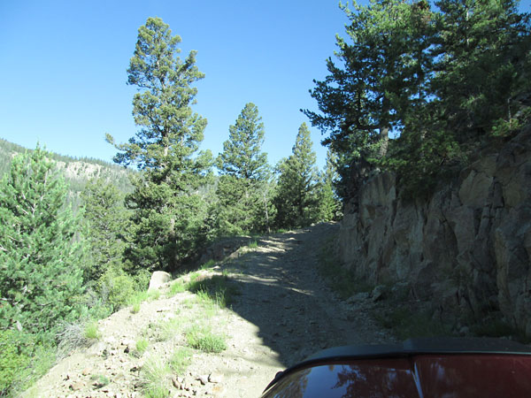 |
Beginning section photo by: Adam M |
|---|
The road will climb above West Alder Creek and head through the forest up the valley. The road is wide, but rough with many eroded sections. After about 4.5 miles you will come to the intersection with Viers Creek, FR611.
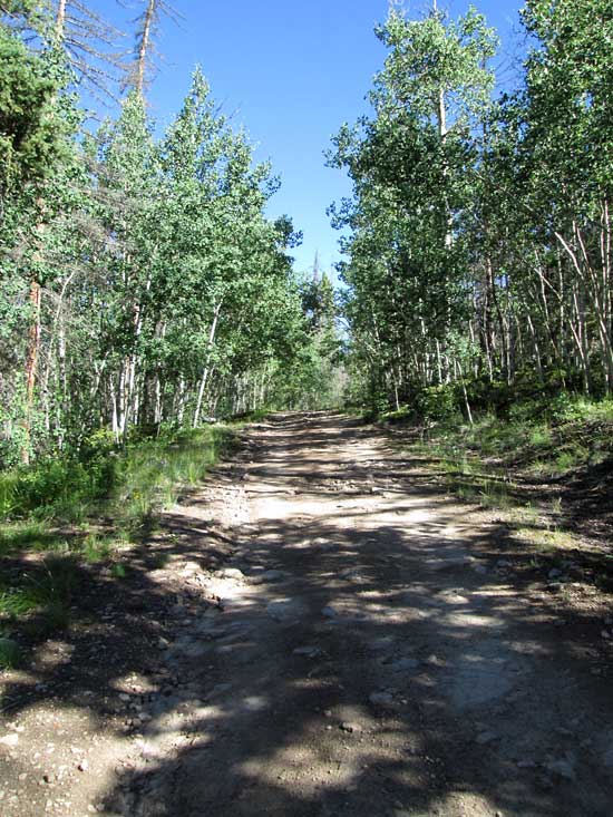 |
Middle section photo by: Adam M |
|---|
 |
Middle section photo by: Adam M |
|---|
Continue on FR610 climbing up the valley. The road will do a few switchbacks as it works down to cross East Creek. After about two miles you will come to the next intersection with Middle Park, FR612. Once again stay on FR610 as it follows Difficult Creek. The next intersection is with West Middle Park, FR613, after about 2 miles. Stay on FR610 which becomes much smoother and better maintained. You will pass large open meadows as you work along the south side of Pool Table Mountain.
 |
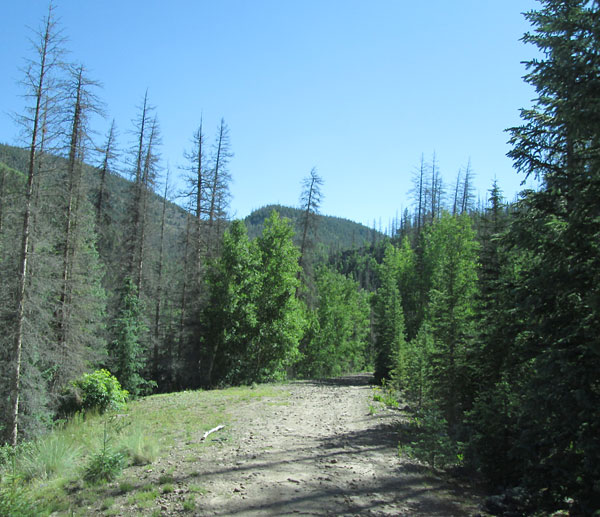
Upper section photo by: Adam M |
|---|
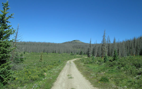 |
Upper section photo by: Adam M |
|---|
The road heads south after crossing the headwaters of West Alder Creek and comes to another intersection after about 3 miles. The road to the left is Blue Park, FR601 which will connect with Pool Table, FR600 to the west. Stay on FR610 and travel another couple miles to the intersection with Pool Table, FR600.