| Difficulty: | Number: | Miles: | Altitude: | Obstacles: | Time: |
|---|---|---|---|---|---|
| Moderate 6 | FR 601 | 30.26 | 9,900 to 11,440 ft. | Steps-3 Rocky-11 Hill-3 |
4-5 hours |
White River National Forest, Rifle District
White River National Forest, Eagle District
0094 County Road 244, Rifle, CO 81650
24747 US Hwy 24, Minturn, CO 81645
(970)625-2371
(970)827-5715
Closure:
July - Best
August - Best
September - Best
October - Early snows possible
Accessed:
Ute-Elk FT2028 - Non-Motorized - Hiking.
Deep Creek Ridge FT2293 - Motorized - Side by Side, ATV, Motorcycle, Hiking, Pack and Saddle.
Cliff Lakes FT1831 - Non-Motorized - Hiking, Pack and Saddle.
Fayville FT2290 OHV - Motorized - ATV, Motorcycle, Pack and Saddle, Mountain Bike, Hike.
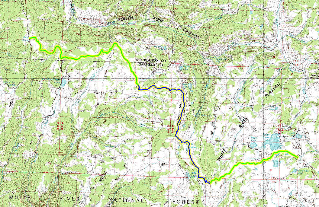
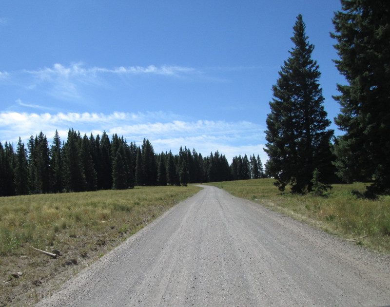
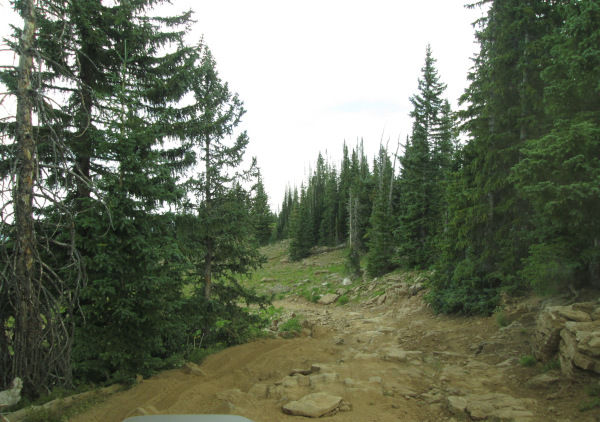
Starting from the west end. From New Castle, CO head toward Wheeler Lane for 0.3 miles. North 7th Street turns slightly left and becomes Midland Ave. Go 0.4 miles. Continue to follow County Road 245 for 4.2 miles. Turn right onto New Castle Buford Road and go 24.1 miles. Turn right onto Forest Road 601.
The area where Carbonate was to be established was Ute reservation land established by the treaty of 1868 making the prospectors tresspassers. Chief Ouray had given orders for his braves to protect their lands. This was a concern for the prospectors, but not enough to keep them away from the area. Supplies were expensive as only a rough wagon road had been constructed following the Ute trail to Coffee Pot Springs. In 1883 a toll road had been constructed from Glenwood Springs to Carbonate helping reduce the cost of transporting goods. Most of the workings were nothing more than prospect holes. By 1880 one of the prospectors, George Ryan, was able to sink a 100 foot shaft. In the spring of 1883 the Carbonate Town Company was formed filing on 640 acres of land, surveying 160 acres for the town site. Carbonate sits on solid rock so building cabins required hauling lumber to the site. About two miles east of town a sawmill was set up. Some cabins were build, but most of the town was made up of tents.
When Garfield County was created in 1883 Carbonate was the only substantial town making it the choice for the county seat. Due to the winter weather at 11,000 feet most of town moved down to Glenwood Springs in the fall. In October of 1883 the county records were brought down to Glenwood Springs as well. In November Glenwood Springs was voted as the new county seat. Carbonate was the county seat for just four months. The post office in Carbonate was opened in 1883 then closed in 1886. Legend has it that E. E. Winslow won the mail service contract for Glenwood Springs to Carbonate which meant going from 5,800 feet and climbing to 10,912 feet. Winslow had unwisely signed up for daily service to Carbonate, making his job even more difficult. After making his first long trek to Carbonate, Winslow found only one old miner at Carbonate. Not wanting to make the long trip up to Carbonate every day he asked the miner how much it would take for him to leave. The miner came up with the amount of one hundred dollars, which Winslow gladly paid. After the miner left Carbonate was a ghost town and no longer required mail service. Carbonate was reported to have had fifteen log homes, a store, and a post office but by 1884 it was a ghost town.
In 1947 Muriel Sibell Wolle went to Carbonate finding a new Forest Service built road that lead to Coffee Pot Springs. This road was made to remove the timber that had been affected by a pine beatle outbreak. At the town site she found the remnants of some of the cabins, but not much else was left. Carbonate is private property and has resident owners that have a few newer summer cabins on the property. In 2014 property owners voted 9–0 to reaffirm the town’s incorporation, even though no one lives there permanently. Carbonate is unique as it is the only incorporated municipality in Colorado with zero permanent residents.
Eberhart, Perry Guide to Colorado Ghost Towns and Mining Camps, 4th ed. Athens, Ohio: ISBN 0-8040-0140-5, 1959, 1969, Print.
Wolle, Muriel Sibell Stampede to Timberline, 2nd ed. Athens, Ohio: Swallow Press, ISBN 0-8040-0946-5, 1949, 1974, Print.
Jessen, Kenneth Ghost Towns Colorado Style, Volumn 2, 1st ed. Loveland, Colorado: J.V. Publications, 1999. Print.
 |
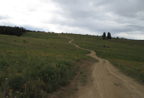
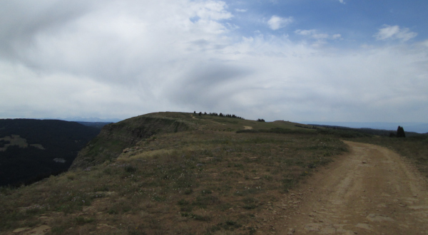
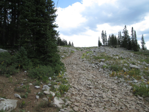
Blair Mountain west end photo by: Adam M |
|---|
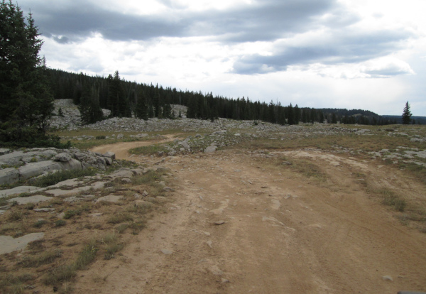
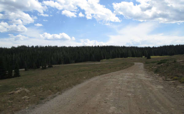
In an open area you will pass two spur roads on the left. The first one is FR601.4X, the second is FR601.8. Both of these roads are short going to campsites that overlook the canyon of the South Fork of the White River. Blair Mountain 4WD road will curve to the right and head toward a small grouping of trees. At the trees you will pass two dispersed campsites. Next you will pass a gated spur road on the left that goes to an area where gravel is produced to maintain the roads. Continuing you will be back in the forest passing through pine and aspen trees. Along a straight stretch you will pass where the Fayville OHV trail, FT2290, connects with the road.
 |
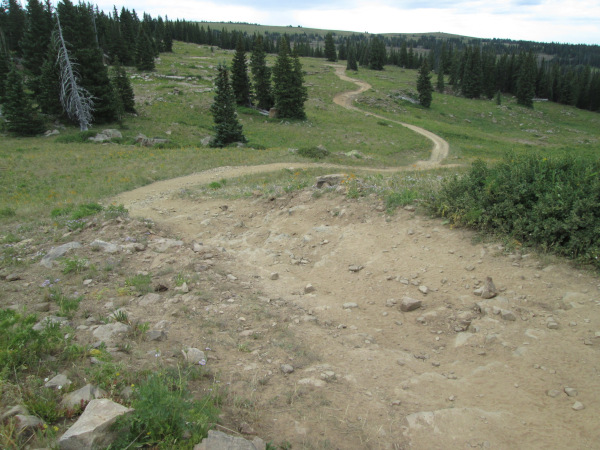
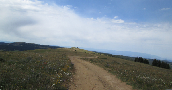
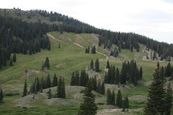
Looking south photo by: Adam M |
|---|
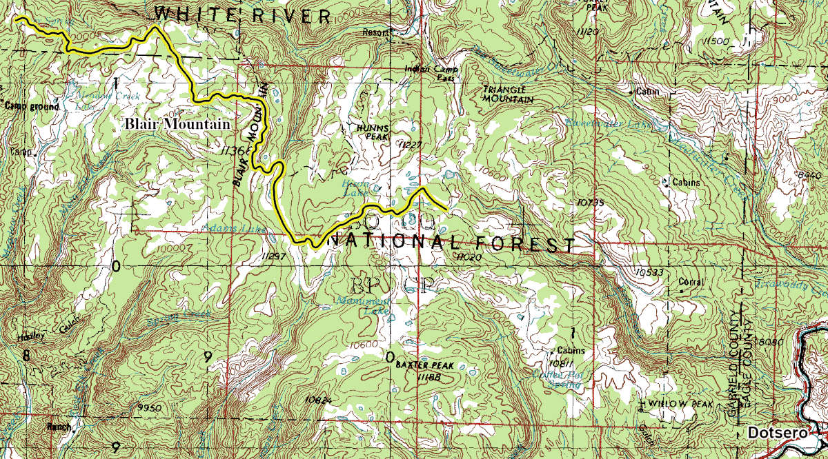
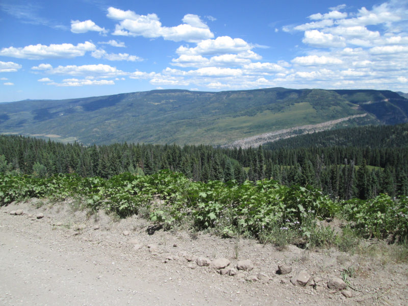
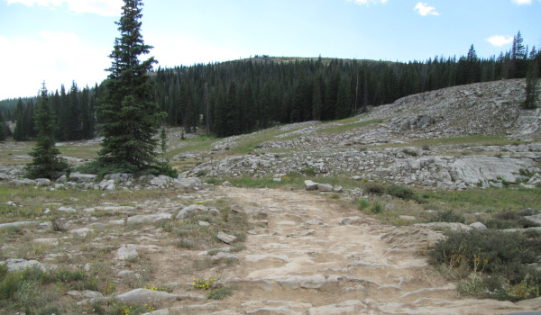
As the road begins to curve to the right you will pass a spur road that goes into the forest to a small parking area. This is where hiking trail FT1831 heads down into the canyon of the South Fork of the White River. Though the maps show this as the start of the Cliff Lakes road, you need to go just a short distance past the parking area to another road on the left that is the Cliff Lakes, FR601.4E, road. The main road will continue through the forest coming out to an open area where you will run along the canyon edge for a short distance and then back into the open meadows passing two dispersed campsites, one on the left and one on the right. Just a short distance further will be another dispersed campsite on the left and the connection with motorized trail FT2293. The road will curve around to the left passing multiple dispersed campsites on the left and right side of the road before coming to a main intersection. The road to the right is the Meadow Lake, FR823, road that heads down to Meadow Lake and a small campground. The main road will head into the pine forest and pass five dispersed campsites before coming into a long narrow meadow. At the far end of this meadow will be another dispersed campsite. After crossing through a section of forest you will come out into another open area and pass two more dispersed campsites on the right. The road will make a sweeping curve to head more southeast passing FR601.3A which goes to two dispersed campsites near the canyon of the South Fork of the White River. After making another small switchback the road will head out into a large open area with small aspen groves. On the right will be FR649 which is at the head of Corral Creek and follows the small creek south. Staying left you will head toward the pines and curve to the right passing Bench, FR647, on the left. Continue right and head down a shallow valley for 2.25 miles which will bring you to another intersection. The road on the right is West Ute Creek, FR648,. Stay left and you will come to another intersection with Cow Lake, FR601.2F, on the left. This road heads to a small trail head and the start of the Crater Lake hiking trail. Stay right to continue on Blair Mountain 4WD road. This is where the road changes to a one lane two track and gets rougher. Just a short distance from the Cow Lake road you will pass a dispersed campsite in the trees on the left. As the road heads into the trees again you will climb a long switchback to get up on a low ridge of Blair Mountain. Blair Mountain is a bit unique in that the west side is a long gradual slope as it heads to the broad top of the mountain while on the east side Blair Mountain is a sheer cliff with a multitude of small lakes on a bench below the peak.
 |
Heading east up to the mountain edge photo by: Adam M |
|---|
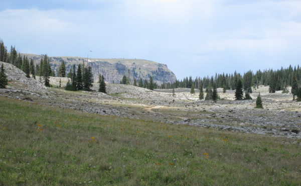
As you follow the ridge up toward Blair Mountain you will pass some interesting landscape with large boulders sitting in open meadows. These are probably remnants of small glaciers.
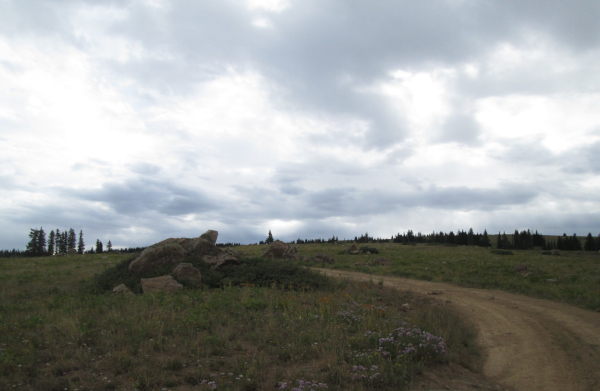 |
Interesting boulder piles photo by: Adam M |
|---|
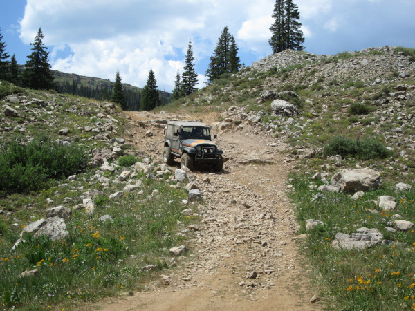
After about two miles the road will climb up two small switchbacks with a few challenging steps to navigate as you continue heading east.
 |
One of the obstacles photo by: Adam M |
|---|
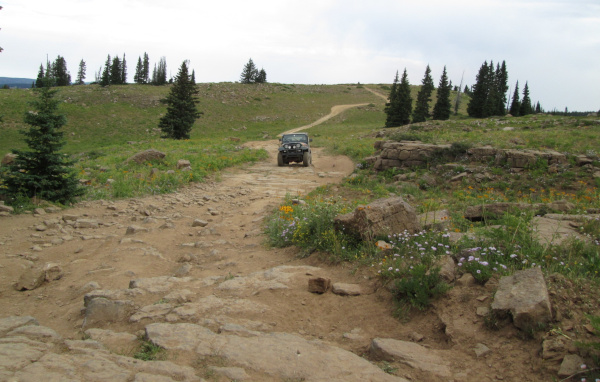 |
Another rough section photo by: Adam M |
|---|
 |
Brian M on one of the steps photo by: Adam M |
|---|
After the larger step the road will cross an open area and pass another spur road on the left, Blair Mountain Overlook, FR601.2E. Stay right and you will follow along the edge of Blair Mountains east side with views out onto the White River Plateau.
 |
Running the edge of Blair Mountain photo by: Adam M |
|---|
The road will head away from the edge of the long cliff of Blair Mountain and climb to the wide top of the mountain.
 |
Blair Mountain's wide top ahead photo by: Adam M |
|---|
From the top of Blair Mountain the road will head down the south side of the mountain getting close to the cliff again above a small lake on the bench below. The road will head into some thin forest again and do a series of switchbacks that contain rocky sections and larger steps to drop off of. Climbing this section would be a bit more challenging.
 |
Starting down to the White River Plateau photo by: Adam M |
|---|
 |
Some of the obstacles photo by: Adam M |
|---|
As you head more to the east you will pass where hiking trail FT2028 connects with the road. The road will drop down through a series of short switchbacks crossing a large rock slab area before passing FR651 on the right. There is one more switchback and obstacle to descend before reaching Patterson Creek coming from Elk Lakes.
 |
View of Elk Lakes photo by: Adam M |
|---|
Just before crossing Patterson Creek spur road 601.2H is on the left, which goes a short distance to the hiking trail FT2048. Cross Patterson Creek and there will be an intersection with FR640 on the left which heads toward Heart Lake. Stay to the right and the road will head south to pass along the side of Elk Lakes.
 |
Down by Elk Lakes photo by: Adam M |
|---|
After passing Elk Lakes you will come to a small switchback with an obstacle on a little hill climb in the rocky landscape of this wide valley.
 |
Obstacle just past Elk Lakes photo by: Adam M |
|---|
After the obstacle the road will head down the wide valley before heading across it to the east and then turning back to the west to cross this broken rock strewn landscape.
 |
Crossing the rocky White River Plateau valley photo by: Adam M |
|---|
 |
More rocky landscape photo by: Adam M |
|---|
As you leave this unique terrain, looking back you get a great view of Blair Mountain, which you just traversed.
 |
Looking back north at Blair Mountain photo by: Adam M |
|---|
You will come to an intersection with Adams Lake, FR601.2C, on the right. This is a more challenging spur road that climbs up on the bench below the Blair Mountain southern ridge to end at Adams Lake. Stay to the left and you will drop down a small rocky hill as you continue on the Blair Mountain 4WD road.
 |
Brian M photo by: Adam M |
|---|
After descending the hill you will cross a small creek which is a branch of Canyon Creek, then cross a short open section before climbing up a double switchback with two obstacles on it. The first obstacle is a rough section at the lower switchback as you make the sharp turn. The second obstacle is past the second switchback as you make a steep climb through a stretch of larger rocks and boulders.
 |
Second obstacle climbing out of the valley photo by: Adam M |
|---|
Once up to the top you will have a view back toward the road to Adams Lake.
 |
The 4WD road up to Adam Lake photo by: Adam M |
|---|
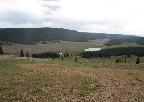
The 4WD road will now head east across some open meadows before entering the forest for a short distance and then coming out into a long open area. This shallow valley is the headwaters of Canyon Creek. You will pass another spur road on the right, FR601.2A, which drops down to follow Canyon Creek for just over 1.75 miles before ending. Staying to the left you will head up the valley to the northeast crossing the treeless rolling hills and one small creek before climbing up again onto another part of the White River Plateau. You will cross through a low saddle between low hills where there is a dispersed campsite on the left that sits below two small lakes higher on the hill. The road will head down off the saddle and cross the southwestern edge of the basin that holds Bison Lake, Heart Lake, and Deep Lake.
 |
Heading across the White River Plateau photo by: Adam M |
|---|
After driving through a small section of pine trees you will come to another intersection with FR233.2 on your right. This is a short spure road that ends at a fence and gate where the old town of Carbonate existed. Today there are private cabins in the trees beyond the fence, but you can still see one of the old homes that has been fixed up.
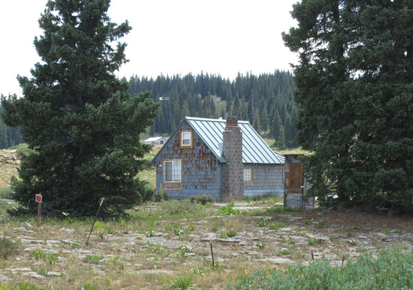 |
One of the cabins at Carbonate photo by: Adam M |
|---|
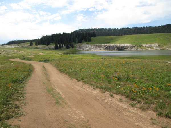
Stay to the left as the road improves to a more maintained and wider route. After just over a quarter of a mile from FR233.2 you will come to another intersection with FR602 to your right. Staying left the road will zig zag its way eastward passing near a small lake. You will pass a spur road on the right that goes to a dispersed campsite near the small lake's shore, and one on the left that goes to a dispersed campsite near some trees. Just past the spur roads you will come to a large intersection. The road on the left is where FR640 connects again. You passed it back just before Elk Lakes. Stay right and you will head east again with the larger Heart Lake to your north and the small lake to your south.
 |
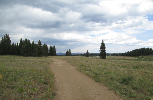
Heading toward the Coffee Pot Road photo by: Adam M |
|---|
As you pass by the small lake you will pass another spur road on the right that goes to two dispersed campsites on the shore of the lake. This is shown on the topo maps as Supply Basin Campground, which is just a few dispersed campsites. The road has become wider and better maintained now. After passing the small lake you will come to another intersection. The road on the left is FR630 that heads to the east shore of Heart Lake. The small spur road to the right is FR601.1B which goes a short distance to a campsite near the small pond out your passenger window. This is shown on the topo maps as Klines Folly campground, basically one dispersed campsite. Continue straight ahead on the Blair Mountain 4WD road for just over a half mile and you will connect with the Coffee Pot Road, FR600,.