Deep Creek Overlook
 |
| Maps/GPS: |


|
| USGS 7.5' Map: |
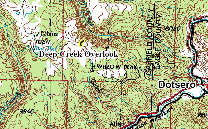
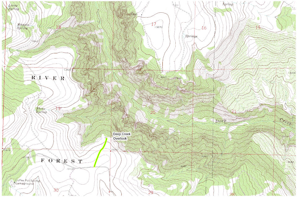
Broken Rib Creek |
| Statistics: |
| Difficulty: |
Number: |
Miles: |
Altitude: |
Obstacles: |
Time: |
| Easy 1 |
FR600.3A |
0.40 |
10,044 ft. |
NA |
1/2 hour |
|
| County: |
Garfield, Eagle |
| Adopted by: |
|
|
|
| Managed by: |
White River National Forest, Eagle District |
24747 US Highway 24 Minturn, CO 81645 |
(970)827-5715 |
| Summary: |
The Deep Creek Overlook is a short spur road off of the Coffee Pot Road that goes to a developed overlook of Deep Creek. |
|
| Attractions: |
Scenery |
Seasonal
Closure: |
Agency - November 23 to May 31
|
| Best Time: |
June - Possible muddy conditions
July - Best
August - Best
September - Best
October - Early snows possible |
Trail Heads
Accessed: |
Deep Creek Overlook FT2019 - Hike
Deep Creek Overlook FT2019.1A - Hike
|
| Camping: |
There are no dispersed campsites along the Deep Creek Overlook road. |
| Base Camp: |
This would be a good area to base camp and explore the 4WD road networks in this area of the White River National Forest. |
| Fall Colors: |
Excellent - The surrounding area has many aspen groves.
|
| Navigation: |
From Gypsum, CO head toward US-6 E. Exit the traffic circle onto US-6 West and go 0.5 miles. At the traffic circle, take the 2nd exit onto Trail Gulch Road and go 0.2 miles. At the traffic circle, take the 2nd exit onto the I-70 W ramp to Grand Jct and go 0.3 miles. Merge onto I-70 West and go 5.0 miles. Take exit 133 toward Dotsero and go 0.2 miles. Turn right onto US-6 West and go 0.7 miles. At the traffic circle, take the 1st exit onto 301/Colorado River Road and go 1.7 miles. Turn left onto Coffee Pot Rd/Deep Creek Rd and go 15.2 miles. Turn right onto the Deep Creek Overlook road, FR600.3A.
From Glenwood Springs, CO head west on 6th Street for 276 feet. At the traffic circle, take the 3rd exit and continue straight onto CO-82 W. Turn left to merge onto I-70 E and go 0.1 miles. Merge onto I-70 E and go 17.3 miles. Take exit 133 toward US-6 E and go 0.3 miles. Turn left onto US-6 E and go 443 feet. At the traffic circle, take the 2nd exit onto 301/Colorado River Rd and go 1.8 miles. Turn left onto Coffee Pot Rd/Deep Creek Rd and go 15.2 miles. Turn right onto the Deep Creek Overlook road, FR600.3A.
|
| History: |
|
| Description: |
The Deep Creek Overlook road starts from the Coffee Pot Road, FR600, and is a wide two track with no obstacles.
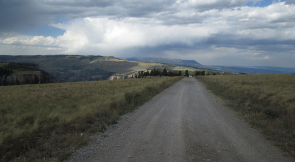 |
Road to the overlooks
photo by:
Adam M |
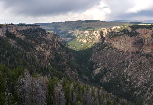
The road will head straight out to a small group of trees where there is a small parking lot. From the parking lot there is a short trail to the east overlook.
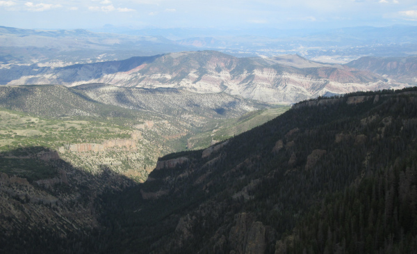 |
View to the east
photo by:
Adam M |
There is also a trail from the parking lot to the west overlook that is a bit longer. The west over look is a bit larger with an old faded Forest Service sign.
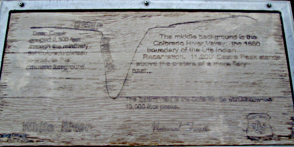 |
Old Forest Service sign
photo by:
Adam M |
 |
View to the west
photo by:
Brian M |
|
|
Data updated - June 27, 2026
4WD Road driven - July 29, 2025
Copyright 4X4Explore.com - 2000-2026 |