

| Difficulty: | Number: | Miles: | Altitude: | Obstacles: | Time: |
|---|---|---|---|---|---|
| 2 | FR373 | 4.85 | 8,480 to 9,040 ft. | NA | 1 hour |
Closure:
July - Best
August - Best
September - Best
October - Early snows possible
From Antero Junction head west on US-24 W/US Hwy 285 S toward US Hwy 285 N for 1.0 mile. Turn right onto Road 311 and go 246 feet. Continue onto County Road 311 for 6.0 miles. Continue onto FR311 and go 1.6 miles. Turn right onto FR373.
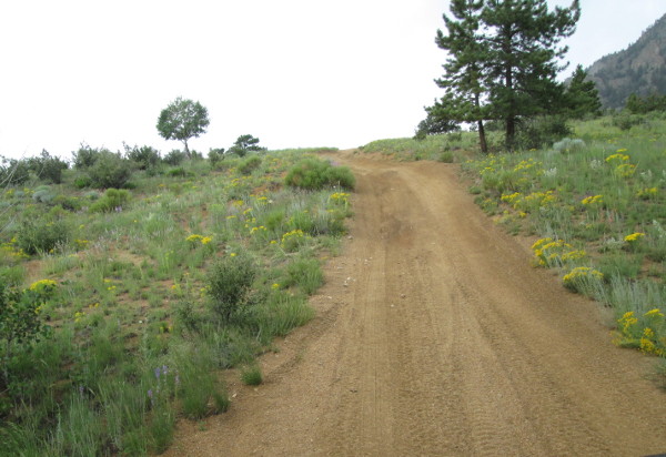
Little Fourmile 4WD road is a nice side route off of Sevenmile, FR311, that loops around Little Fourmile Creek. Starting from a large Y intersection you will leave Sevenmile Road and head west along a spur ridge off of Marmot Peak.
 |
Eastern end looking toward Marmot Peak photo by: Adam M |
|---|
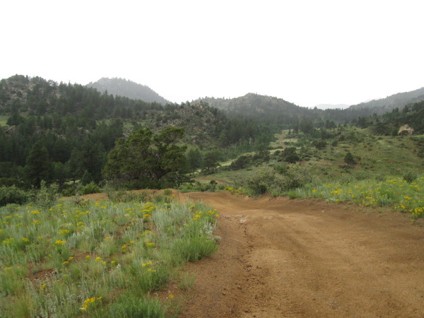
The road is a wide single lane mostly sand and gravel with a few steps of rock. You will climb over a few small rolling hills and start to climb a longer hill. As you climb up you will pass the parking area for the Aspen Arch Trail on your right.
 |
One of the little hills photo by: Adam M |
|---|
As you make the top of the hill there will be two spur roads. The one on the left goes to a dispersed campsite. The on on the right goes over to the buried water pipeline. From the top of the hill the road will drop down the other side, which is steeper, and make a few turns before entering into the Little Fourmile drainage. After following the drainage for a short distance you will pass a spur road on the right that goes to a campsite.
 |
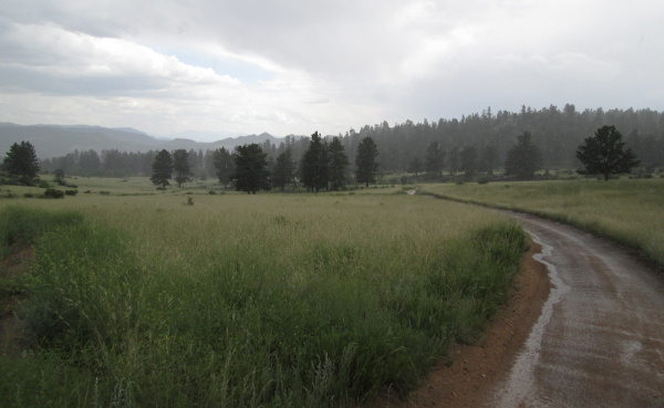
Near the head of Little Fourmile Creek photo by: Adam M |
|---|
Past the spur road you will cross the shallow Little Fourmile Creek near it source, a small spring in the ridge to the northeast. After crossing the creek the road will climb up through a few trees to another intersection. The road to your right is FR373A, a spur road that ends in less than a quarter mile at the Davis Meadow trailhead, FT1413.
Stay left to continue on FR373. After passing through a few trees you will come out into a large open area with a few stands of trees.
 |
Looking south after crossing the head of the creek photo by: Adam M |
|---|
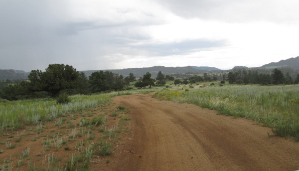 |
Open meadow photo by: Adam M |
|---|
The road will continue across this open area for a mile and a quarter, passing a dispersed campsite along the road, before coming into a more rocky area. The road will wind through some small rolling hills passing rock outcrops before dropping into a sandy wash. After a short distance you will come to a large Y intersection. The road to the left is FR373, the road to the right is FR375.A, a spur road of Fourmile Creek, FR375. Stay left here and head south along a small rise. The road will take you through a thinly forested area before you come to another intersection. The road you intersect with is Sevenmile, FR311, which will take you back to your starting point if you go left. The right is also FR311, that will head down hill along a small drainage passing two dispersed campsites along the way. The road will then climb over a wide hill and drop down to an intersection with the Lenhardy Cutoff, FR376/CR376. The left will take you southeast toward Hwy24, the right will take you to Fourmile Creek, FR375, after about a mile.