

| Difficulty: | Number: | Miles: | Altitude: | Obstacles: | Time: |
|---|---|---|---|---|---|
| Graded | FR 106 | 10.05 | 9,698 ft. | NA | 1 hour |
Parks Ranger District
Walden, Colorado 80480
Closure:
July - Best
August - Best
September - Best
October - Early snows possible
Accessed:
FT1226.1B - Motorcycle
FT1226 - Motorcycle
From Granby, CO head west on US-40 W/E Agate Ave toward South 1st Street. Continue to follow US-40 West for 3.0 miles. Turn right onto CO-125 North and go 26.4 miles. Sharp left onto Forest Service Road 106.
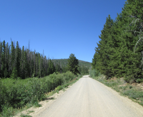 |
Start of Willow Creek photo by: Adam M |
|---|
After just over a mile you will come to an intersection. The road to the left goes a short distance to the Willow Creek Trailhead. Stay right to continue on FR106. The road will cross a wide marshy creek which is the East Branch of Willow Creek. You will head into a more forested area with a few pulloffs to dispersed campsites. You will come to another intersection in the forest. The left is East Branch, FR735, which will head south and connect to Haystack Mountain, FR730. Stay right again and continue through the forest. The road will come out into another open area and cross a branch of Spring Creek on a wide sweeping curve. There will be a dispersed campsite along the road at this curve. You will head back into the forest and climb a low ridge before dropping down to cross the main branch of Spring Creek on another sweeping curve. The road will climb another small ridge passing more dispersed campsites then dropping down to cross a small creek before crossing the last low ridge and entering the main valley of Willow Creek. After crossing the creek you will come to a spur road to the right, Green Willow which is FR734 and FR734.1A, which only goes a mile to the public lands boundary. At this intersection will be a number of dispersed campsites. Staying left on the main road you will now head south following Willow Creek.
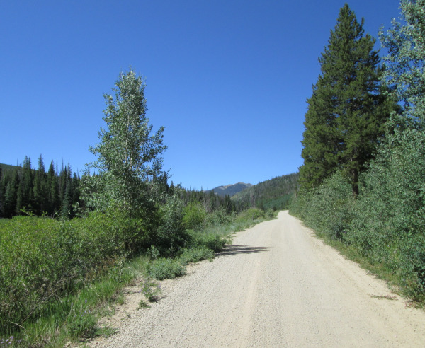 |
Willow Creek photo by: Adam M |
|---|
The road will head up the valley passing a few dispersed campsites for about two miles before coming to another intersection. The road to the right is Rock Creek N.P., FR715, which goes northwest toward Green Ridge for six miles before ending. Staying to the left you will continue following Willow Creek. Shortly you will come to another intersection. The right is one end of Haystack Mountain, FR730. Staying left you will cross to the other side of Willow Creek and pass another dispersed campsite. Motorcycle trail, FT1226.1B takes off from here as well. The road will become a wide two track now, but will still be somewhat maintained.
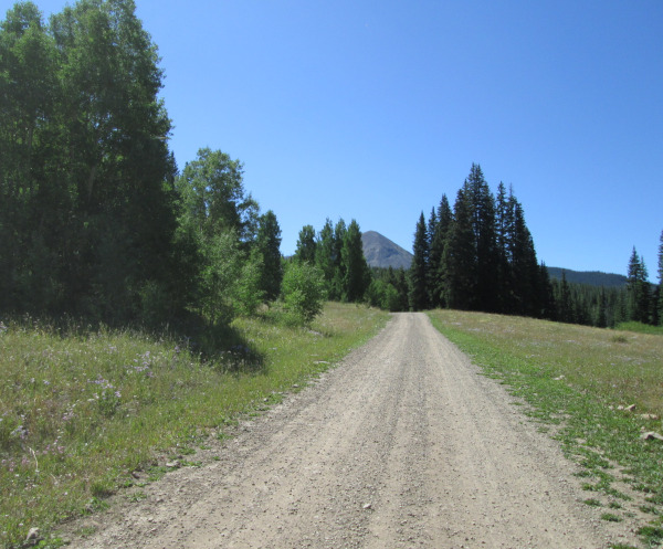 |
Middle section photo by: Adam M |
|---|
Along this section the forest will thicken with fewer open areas. You will pass a few dispersed campsites along this section. The road will cross back to the other side of Willow Creek then cross back again. Here there will be another group of dispersed campsites. The road will now climb into the forest and become steeper and rougher. It will then connect into Haystack Mountain, FR730. From here you can head left toward Willow Creek Pass and Hwy 125, or right which heads back to last intersection with Haystack Mountain, FR730.